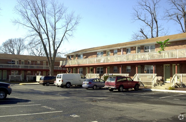
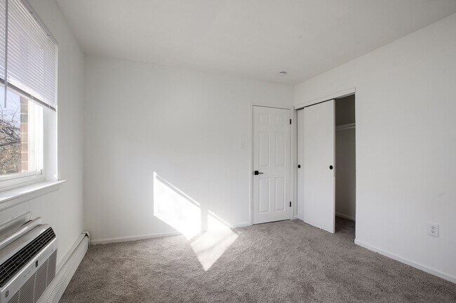
Property Record
198 W Hampton St, Pemberton, NJ 08068
NEARBY LISTINGS FOR SALE OR LEASE
-
-
View all Pemberton listings for sale on LoopNet.com
Property Detail
198 W Hampton St
Philadelphia-Camden-Wilmington, PA-NJ-DE-MD
ADDITIONAL LOTS: SALE INCL BL100.01LTS5.01/5.02
28-00102-0000-00003-01
Burlington
Apartment
New Jersey
X
3.1
34005C0279F
0.60 AC
2024
Lower Burlington County
2025
Philadelphia
702300
DEMOGRAPHICS near 198 W Hampton St
1 Mile
3 Mile
5 Mile
2024 Total Population
3,320
8,763
31,574
2029 Population
3,398
8,949
32,298
Pop Growth 2024-2029
+ 2.35%
+ 2.12%
+ 2.29%
Average Age
42
43
43
2024 Total Households
1,390
3,489
12,224
HH Growth 2024-2029
+ 2.37%
+ 2.24%
+ 2.53%
Median Household Inc
$68,565
$68,173
$73,855
Avg Household Size
2.40
2.40
2.40
2024 Avg HH Vehicles
2.00
2.00
2.00
Median Home Value
$229,733
$240,992
$261,990
Median Year Built
1967
1967
1979
Nearby Places
Map Layers
Map Styles
 Street
 Aerial
- Restaurants
- Banks
- Shops
- Fitness
- Groceries
PUBLIC TRANSPORTATION
AIRPORT
Trenton Mercer
DRIVE
WALK
Distance
Trenton Mercer
42 min
28.2 mi
Philadelphia International
DRIVE
WALK
Distance
Philadelphia International
52 min
34.5 mi
Freight Ports
Port of Philadelphia
DRIVE
WALK
Distance
Port of Philadelphia
35 min
24.6 mi
Nearby Properties
Address
Land Use
TOTAL SIZE
Lot Size
Zoning
Address
Land Use
TOTAL SIZE
Lot Size
Zoning
167.21 AC
Address
Land Use
TOTAL SIZE
Lot Size
Zoning
Address
Land Use
TOTAL SIZE
Lot Size
Zoning
97.88 AC
Address
Land Use
TOTAL SIZE
Lot Size
Zoning
351.92 AC
Address
Land Use
TOTAL SIZE
Lot Size
Zoning
24.70 AC
Address
Land Use
TOTAL SIZE
Lot Size
Zoning
63.60 AC
Address
Land Use
TOTAL SIZE
Lot Size
Zoning
30.26 AC
Address
Land Use
TOTAL SIZE
Lot Size
Zoning
37.46 AC
Address
Land Use
TOTAL SIZE
Lot Size
Zoning
88.50 AC
MR
Address
Land Use
TOTAL SIZE
Lot Size
Zoning
17.83 AC
Address
Land Use
TOTAL SIZE
Lot Size
Zoning
65 AC
I
Address
Land Use
TOTAL SIZE
Lot Size
Zoning
11.96 AC
Address
Land Use
TOTAL SIZE
Lot Size
Zoning
Address
Land Use
TOTAL SIZE
Lot Size
Zoning
5,480 SF
8.41 AC
Address
Land Use
TOTAL SIZE
Lot Size
Zoning
4.55 AC
Address
Land Use
TOTAL SIZE
Lot Size
Zoning
14.63 AC
HC
Address
Land Use
TOTAL SIZE
Lot Size
Zoning
2.49 AC
Address
Land Use
TOTAL SIZE
Lot Size
Zoning
25 AC
HCRR
Address
Land Use
TOTAL SIZE
Lot Size
Zoning
58.55 AC
Address
Land Use
TOTAL SIZE
Lot Size
Zoning
93.68 AC
Address
Land Use
TOTAL SIZE
Lot Size
Zoning
3,920 SF
119.62 AC
Address
Land Use
TOTAL SIZE
Lot Size
Zoning
6.60 AC
I
Address
Land Use
TOTAL SIZE
Lot Size
Zoning
9.48 AC
I
Address
Land Use
TOTAL SIZE
Lot Size
Zoning
8,320 SF
3.26 AC
Address
Land Use
TOTAL SIZE
Lot Size
Zoning
3.76 AC
Address
Land Use
TOTAL SIZE
Lot Size
Zoning
5,349 SF
1 AC
APPL
Address
Land Use
TOTAL SIZE
Lot Size
Zoning
4,568 SF
6 AC
Address
Land Use
TOTAL SIZE
Lot Size
Zoning
2.64 AC
Address
Land Use
TOTAL SIZE
Lot Size
Zoning
3.04 AC
HC
Address
Land Use
TOTAL SIZE
Lot Size
Zoning
0.93 AC
The World's #1 Commercial Real Estate Marketplace
Connect with us
© 2026 CoStar Group
The information above has been obtained from sources believed reliable. While we do not doubt its accuracy we have not verified it and make no guarantee, warranty or representation about it. It is your responsibility to independently confirm its accuracy and completeness. Any projections, opinions, assumptions, or estimates used are for example only and do not represent the current or future performance of the property. The value of this transaction to you depends on tax and other factors which should be evaluated by your tax, financial, and legal advisors. You and your advisors should conduct a careful, independent investigation of the property to determine to your satisfaction the suitability of the property for your needs.